UPDATE - 8 p.m. Thursday: The National Weather Service has issued a TORNADO WATCH for East Baton Rouge, West Baton Rouge, Ascension, Assumption, Iberville, East Feliciana, Livingston, Pointe Coupee, St. Helena, St. James, St. Mary Tangipahoa and West Feliciana Parishes until 3 a.m. Friday.

A TORNADO WATCH means conditions are favorable for tornadoes and/or damaging winds in and around the watch area. Be on the lookout for threatening weather conditions and listen for later statements and possible warnings. If a tornado warning is issued, seek shelter in a low-level, interior room of a sturdy building. Take pets (on a leash) with you, have on hard-soled shoes, monitor storm coverage on a wireless device and cover your head in the event of wind or tornado impact. For more on tornado safety, CLICK HERE.
A broken squall line will move east into southeast Louisiana this evening and progress east across the Watch area tonight. In addition to the risk for a couple of tornadoes, severe gusts (60+ mph) capable of wind damage may accompany the more intense portions of the squall line.
The National Weather Service has issued a FLOOD WATCH for East Baton Rouge, West Baton Rouge, Iberville, East Feliciana, Ascension, Livingston, Pointe Coupee, St. Helena, St. James, Tangipahoa and West Feliciana Parishes as well as, Amite and Wilkinson Counties until 7 a.m. Saturday.

A FLOOD WATCH means conditions may develop that lead to flash flooding. Flash flooding is a very dangerous situation. Be on the lookout for threatening weather conditions and listen for later statements and possible warnings. For more on flooding safety, CLICK HERE.
Multiple rounds of storms will be moving through the area beginning Thursday night and continuing into Saturday morning. 1 to 4 inches of rainfall with locally higher amounts in excess of 6 inches will be possible, enhancing the flash flooding threat.
Tonight & Tomorrow: As advertised for several days, the first round of heavy thunderstorms arrives on Thursday night. Storm chances dramatically increase after dark, with storms arriving anywhere between 8 p.m. and midnight in the capital area. Widespread showers and storms are likely at least until midnight. The coverage tapers off as we get closer to 3 a.m.. We'll keep isolated storms in the forecast through daybreak, but the coverage appears to be lesser for the morning drive.
Isolated instances of severe weather will be possible as these storms pass through. A warm front will be arriving in the area as the night wears on, and areas along and south of this boundary will end up having the highest chance of seeing stronger storms. The Storm Station believes that areas along and south of Baton Rouge will be in this zone. Damaging straight-line winds are the primary concern, although isolated large hail and tornadoes cannot be ruled out either. A Tornado Watch is in effect through 3 a.m. Friday for all of our Louisiana parishes. Although areas north of the warm front appear to have a smaller severe risk, the flash flooding threat will be higher.
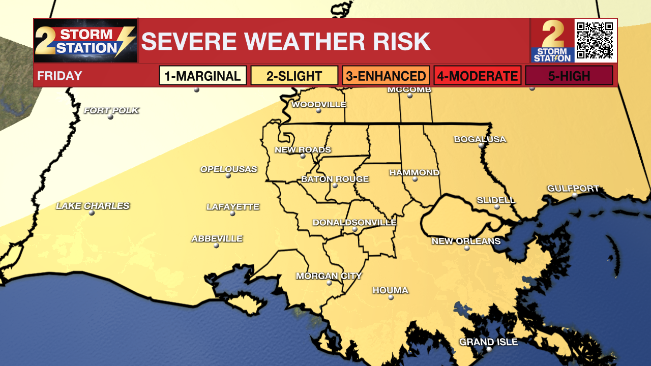
While overall rain coverage will be limited for the first part of our Friday, clouds remain and highs will still manage reach the middle-80s. We do anticipate another round of showers and storms by afternoon and evening. The potential is there for heavy rain and strong storms yet again. Have alerts turned on and keep an eye to the sky so you're not caught off guard. The Storm Prediction Center has placed the entire region under a slight (level 2/5) risk of severe weather on Friday.
Up Next: A few more waves of storms appear likely on Friday night. While the severe weather threat should be lower with the storms into early Saturday, they still pose threat of flash flooding. Lingering storms will be possible for the first part of our Saturday. Fortunately, rain coverage will only decrease throughout the day. By afternoon Saturday, much more sunshine will be available though, and high temperatures will be pumped into the upper-80s. Sunday through early next week will be warm and muggy with highs near 90° and lows near 70°.
Get the latest 7-day forecast and real time weather updates HERE.
Watch live news HERE.
Remember that the WBRZ WX App. is *free* on Apple and Android devices and can be used for breaking weather information, live radar, and forecast details. You can also use it to watch live coverage if power or broadcast signal is ever lost. For even more, connect with the Storm Station on Twitter and Facebook. Stream WBRZ+ for continuous information as it becomes available.
Click HERE to watch WBRZ streaming live online
Click HERE for the WBRZ weather page.
Click HERE to see how to download the WBRZ weather app.
Posts below are from the WBRZ Weather X account. Monitor for weather warnings below.


